IA wins 3 Merit Awards at 2013 ASLA NCC Awards
![]()
We’re pleased to share that IA received 3 awards in this year’s ASLA Northern California Chapter Design Awards! We were awarded 3 Merit Awards for our work on the 555 Bartlett Courtyard, Bay Area Remediation Site: 1, and the San Francisco Botanical Garden Pathway Improvements. You can see our award winning projects on the ASLA NCC website.
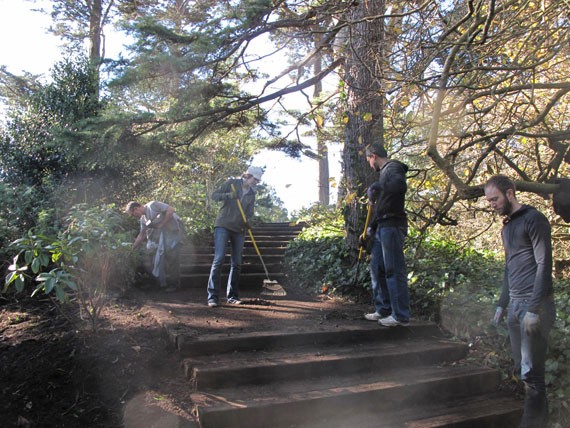
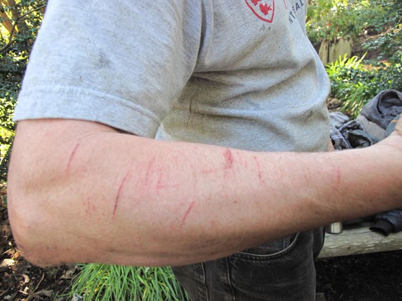
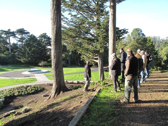
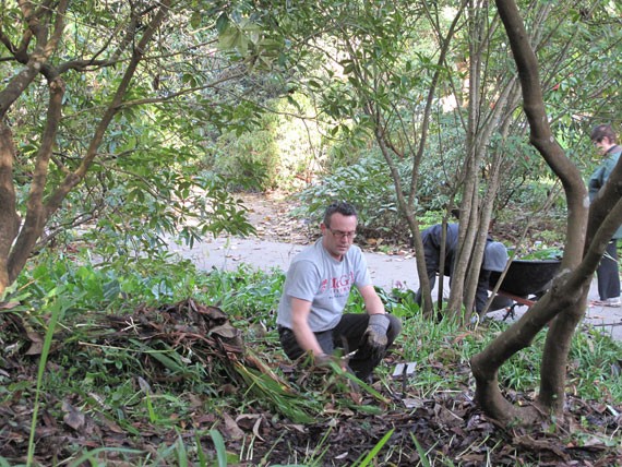
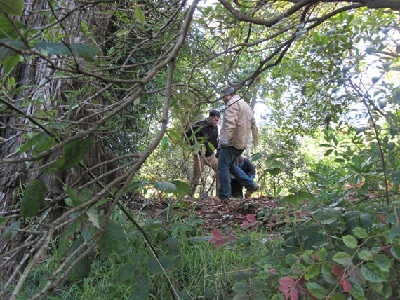
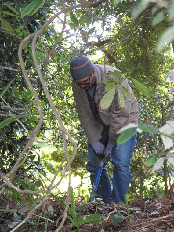
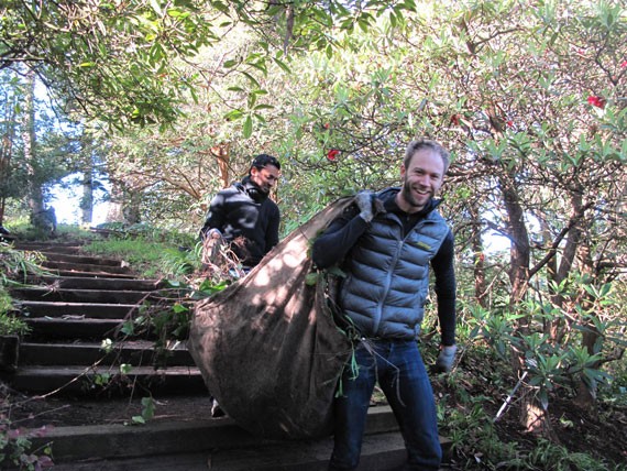
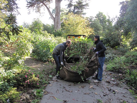
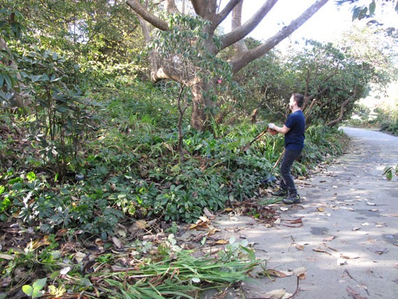
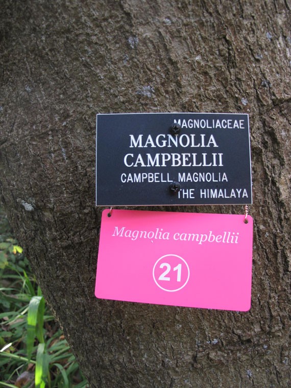
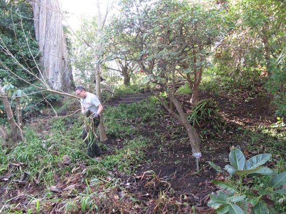
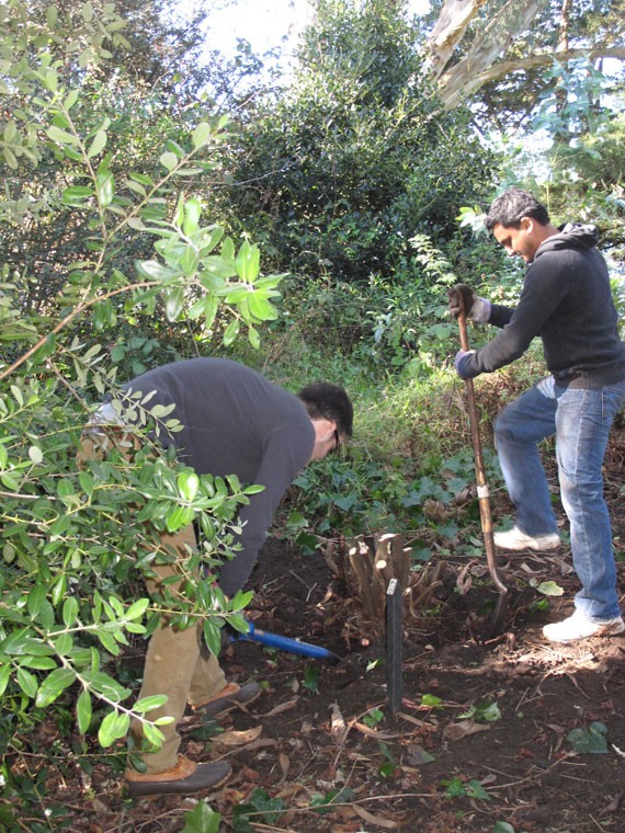
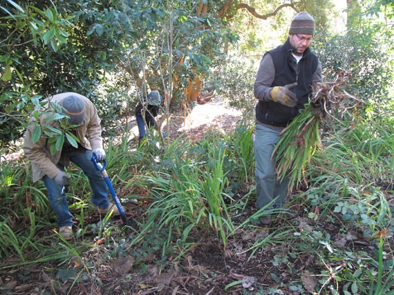
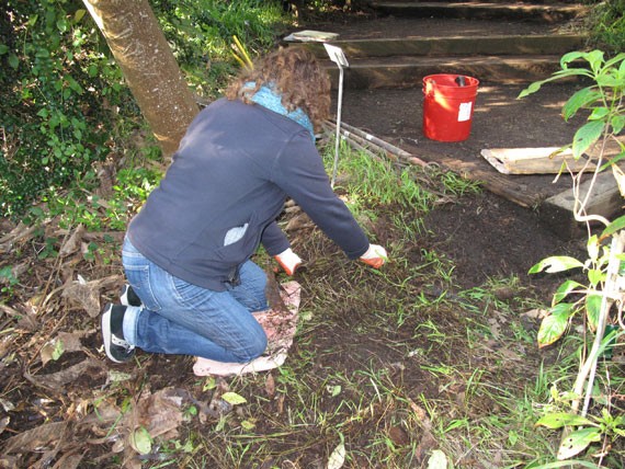
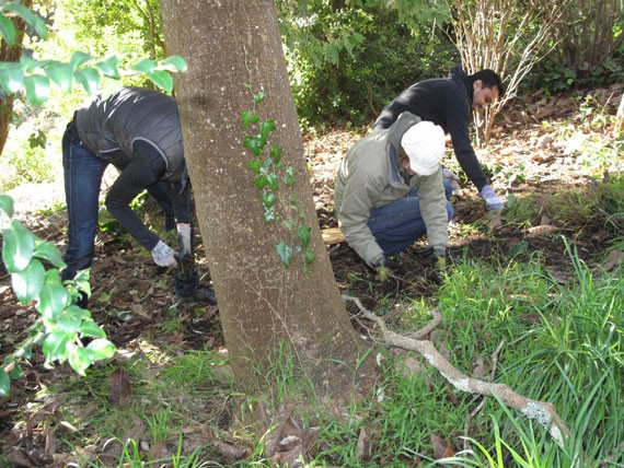
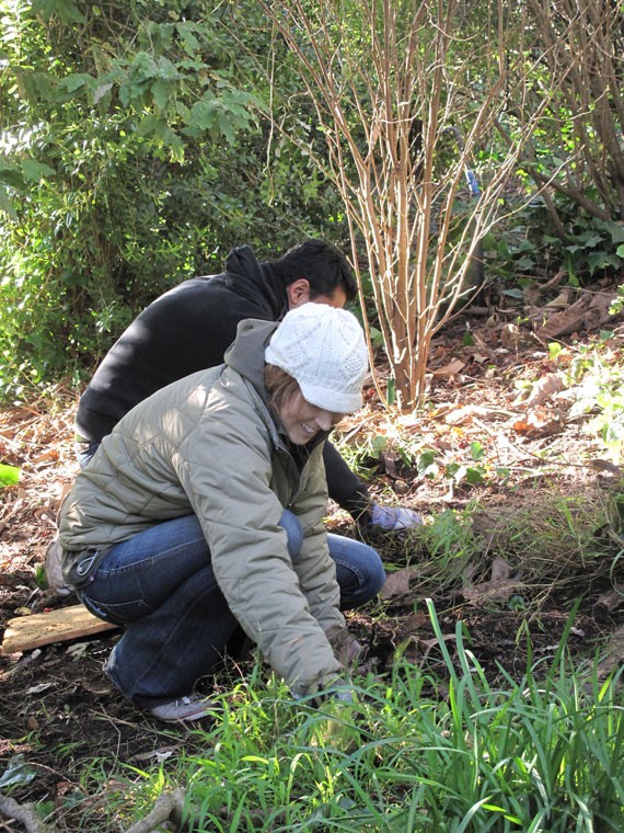
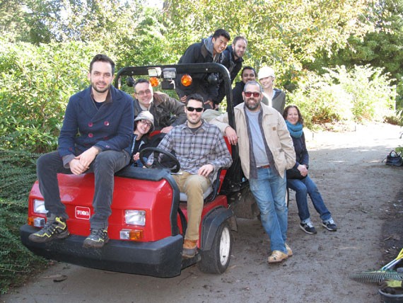
INTERSTICE Architects 'Digs In' at the SF Botanical Garden
Check out the pictures from our volunteer day at the San Francisco Botanical Garden – IA spent a day helping SFBG Gardener Jason Martinez weed, aerate and plant a grove of Rhododendrons in a section of the Mediterranean Basin known as Heidelberg Hill. If you’re interested in volunteering your time to assist the SFBG, check out their website – the Garden relies heavily on volunteers like yourself to assist them in a variety of different ways, and no prior gardening experience is required!
INTERSTICE Architects in arcCA

INTERSTICE Architects’ project ‘Bay Remediation Site: 1″ has been published in arcCA’s Winter 2012 Design Awards Issue! BRS:1 won an AIACC Urban Design Merit Award earlier last year, and the issue features our project as well as all the other AIACC award winners. This is BRS:1’s fourth award in the last 3 years, having previously received awards from the California Architectural Foundation, AIA San Francisco, and an international Green Dot Award for sustainability. You can check out the project on page 46.
Parking Day 2012 – Lighter than Air


Parking Day 2012 – Lighter than Air, a set on Flickr.
We’d like to thank everyone that joined us this past Friday for Parking Day 2012! We had a great time meeting all of you, and we hope you enjoyed our “Lighter than Air” installation and the tasty Malaysian food courtesy of mamakSF! If you have any photos that you’d like to share (maybe you and your friends riding Public Bike’s Whimcycle, or lounging on our yoga ball furniture?) please post them here!
Also, be sure to check out our Flickr photo album!
Bay Remediation Site: 1 Published in Landscape Architecture Magazine

We’re pleased to share that our project “Bay Remediation Site: 1” has been published in on page 38 of this month’s issue of Landscape Architecture Magazine! The article features an interview with IA’s Andrew Dunbar and Zoee Astrakhan, and illustrates how the project investigates our office’s critical interest in blurring the lines between landscape, architecture, and infrastructure in order to create smarter systems that both rehabilitate our environment and create positive public spaces.
As discussed in the article, we believe there could be potential for projects such as BRS:1 to transition from the realm of theory to reality by gaining traction with local and state governments After the introduction of New York’s High Line, the collective interest of cities across the country to invest in green, urban, public spaces has been piqued. San Francisco is no stranger to this phenomenon – with the renovation of the SF/Oakland Bay Bridge being the city’s primary focus of a plethora of design proposals. As interesting as many of these ideas are, we believe that the project of “Green-Space-as-Destination-Infrastructure” could move beyond purely reclaiming derelict infrastructure for the purposes of tourism and urban revitalization.
Spanning hundreds of miles of coast line, “The Bay” is easily San Francisco’s most significant geographical characteristic – one that is deteriorating due to factors such as water pollution, environmental loss, and global climate change. We hope that BRS:1 can function as an in-road to discussing the potential benefit landscape infrastructure can have to creating destination green spaces that not only draw people and prestige to the city, but rebuild our coastal environment and foster community involvement and educational opportunities as well.
Public Networks of Urban Access

This past September, San Francisco held it’s annual “Architecture and the City Festival”. This year’s theme, “Investigating Urban Metabolisms,” asked participants to “… take an in-depth look at hidden and emergent systems that generate form, movement, growth and entropy in the city.” Taking part in the event, our office organized an exhibit titled “Public Networks of Urban Access,” which presented a variety of pedestrian open spaces developed in the city within the past 20 years, and analyzed the various emergent relationships that exist between them.
The exhibit interprets the festival’s theme of “Urban Metabolisms” by comparing the networks formed by these spaces to the various systems of the body and the roles they serve as parts of a unified whole. The aim of this process is to find creative ways to de-familiarize these sites so new interpretive value can be found – value which may guide future design strategies affecting the public space of the city. The detailed conditions, specific to each site, provide a broad basis for investigation, linking the various open spaces geographically, ecologically, socially, and historically.
Pedestrian Networks function in the body of the City in a multiplicity of ways. They are designed to accommodate the human body, but also function environmentally and experientially. As a CIRCULATORY system, they get us from here to there; as a RENAL system, they filter water and air, improving our health and sustaining us; and as a NEURAL network they communicate the mutable natures of the urban environment – the haptic, visual, auditory and olfactory. This analogy provides us with the impetuous to explore the “comparative anatomy” of several recently improved San Francisco pedestrian networks and is meant to stimulate further exploration through estranging the familiar – revealing new perspective so that we can discover (experience) them anew.
The projects presented, all of which provide access to wild landscapes, sensitive areas and waterfront, are intentionally diverse, and are categorized into one or more of the following: Topographic Access, Pedestrian Streets, Water Access, and Access to Sensitive Habitats. With each of the twelve projects represented we provided a field of comparative data, an abstract, communicating a brief history, the scope of the contemporary improvement, plan and sectional graphics, and an example of the designer’s vision or other experiential material – all meant to educate, awaken and inspire further exploration through self-guided visits to the individual projects.


The projects are mapped onto various aspects of San Francisco to contextualize them in relation – to water, sound, neighborhoods, and other urban metabolisms and emergent systems- all play a role in how we know and understand these places.
The projects selected and showcased are a small selection of the emerging network of pedestrian access and pedestrian-centered environments that have been designed, built and improved upon in the last two decades in San Francisco. The emerging pedestrian network is one that highlights the changing priorities of urbanites nation-wide, newly oriented toward more ecologically diverse experience in the urban environment. The newly designed and built artifacts and architectural elements are bringing us into closer contact with lost ecological systems, habitats and wilderness, and are sheltering us from the effects of the automobile. Through their re-design, sidewalks, streets and parking areas are being reclaimed as places for water, plants, birds, insects and simultaneously, as places for people.

(Parking Day - example of temporary pedestrian appropriation of space typically dedicated to cars.)

To make matters even more complex, the lack or presence of humans on a site becomes a variable to wildlife as well, thus developing reflexive relationships between humans and wildlife.

The city’s open spaces have been developed organically – often shaped by circumstances unique to the era in which they were built. The histories of these sites then record, in part, the history of the city’s development. But a new impetus in public space design which has prioritized returning sites to their states before the settlement of San Francisco inverts the relationship of history and site by using the space of the public site to explore the natural history of the Bay. Since the city was settled so rapidly, it is uncertain what exactly the San Francisco landscape looked like ages ago, or how biotic communities functioned prior to human settlement. Public efforts are returning most of the ecologies studied to their “native” states.

- (Forensic Ecology – Growing interest in the natural history of cities have produced studies showing what cities might have looked like before human settlement. This image shows New York’s Battery Park circa 1700.)
These sites become forensic in nature. They tap into the growing interest in researching the ecological past of what are now dense urban centers. New open space projects that leverage the findings of this research establish connections between the pedestrian and the natural history of the city and provide a new context within which to situate proposed projects that link the various open natural spaces within to city creating new systems or supplementing existing ones. Sites which excavate the natural past for present populations have substantial projective value, and concerted efforts on the part of ecological historians and designers to work together could pay high dividends in enriching urban public spaces and creating more sites where nature may re-establish itself within the confines of the city. This is a theme we have investigated in past projects such as our investigation, “Agri-Structure | Eco-Structure,” and is one that we firmly believe carries great potential.
Another dimension relating to the pattern of development of San Francisco’s urban spaces is the organic, piecemeal process in which this network has taken shape. While San Francisco boasts a wide range of scale and size in its public open spaces, these parks, alleys, and pockets of green are most often discrete objects – relationships with other open spaces are either non-existent or have evolved through creative temporary programming often organized in grassroots fashion by city dwellers (take for example, the many small farmers markets that transform otherwise quiet streets between neighborhoods into temporary pedestrian public spaces). This pattern stands in stark contrast to cities such as Boston, which have historical precedents for large public space meta-projects (ie, Olmstead’s Emerald Necklace, and the recently completed Central Artery Project). This is an example of a process that is the polar opposite of the pattern of open space development in San Francisco. However, while these meta-projects laudably attempt to create defined connections between multiple public spaces, the very nature of their planning and construction is disruptive, costly, and time consuming. Despite these inherent drawbacks, their scale also carries visionary portent and suggests a greater city that could leverage its emergent possibility when perceived on the macro scale. We would like to propose such a project.

(Boston's Central Artery - Proposed Open Spaces)

(Re-scripted uses for existing public space questions the necessity of large-scale infrastructural intervention.)

(Pavement to Parks (San Francisco) - An example of small scale public space design as a counterpoint to large-scale infrastructural overhaul.)
Given these precedents, our study’s proposal is for a project has not yet taken shape. This project would combine the discrete nature of San Francisco’s public spaces, the grassroots community involvement of the city’s population, and the vision and foresight of larger infrastructural projects. Could a planned network of temporary and permanent small scale urban spaces that collectively assist in filling the gaps between the city’s existing public urban spaces combine these three strategies successfully? Such a project could breathe new life to under-utilized spaces, find new uses for unnecessary program, and bridge successful sites with each other, creating a new layer of experience within the city. The discrete and small scale nature of each individual project would encourage community involvement and private investment into collective urban spaces. The large-scale vision of the project would ensure that these sites form relationships with existing public spaces, and create a new pedestrian experience within the city – encouraging further investment and community involvement.
We believe that the San Francisco’s goal should be nothing short of being the premiere pedestrian city in the country. A pedestrian open-space network such as we propose would form the basis for a new sense of what a “landmark” project entails – monumental in ambition but without the need for monumental form. To achieve this, we believe that a new metabolism or systemic project that is connected and incremental is necessary, finally evolving into a fulfilled promise for a better pedestrian city.
Agristructure | Ecostructure Featured in arcCA

We are pleased to have our submission to the 2009 Off Grid 2.0 competition featured in the Works/Sectors Issue ( issue 09.4) of arcCA! Our project, titled “Agristricture | Ecostructure,” was awarded the Special Jury Commendation which in the words of the jury, “Was a very ambitious entry that explored teaching opportunities to a high degree … This solution is highly engaged in activities that support environmental learning.” The competition brief called for creative solutions to the remediation and redesign of Horseshoe Cove, a small ecological infill site that was once a marshland, drained and reclaimed by the military in the 1800s.

View of the New Horseshoe Cove from Kayak Launch
This project creates a high visibility public infrastructure that addresses the dynamic condition of the greater San Francisco Bay area ecosystem while creating a framework through which users may experience the ever changing local conditions of the site.
Given the increasingly complex shifts being brought upon Bay Area ecologies by global climate change, we believe that landscape itself can be a type of generative “soft” infrastructure, not only capable of fostering local remediation, but acting as an synthetically maintained ecological system which “seeds” other at risk ecological infill sites – re-establishing processes halted by years of development and environmental disruption.
Inspired by the research of Dr. Katharyn Boyer, the project’s two major functions are the replenishment of native eelgrass, and the production of critical natural resources to be used in a larger Bay-Wide remediation scheme.

Site Strategy
This solution is initiated by first re-distributing the sea wall boundary, and transforming the site into a blurred tidal edge. We employ a series of simple performance typologies to create a sustaining landscape, and water/land ecologies evolve as we re-appropriate agricultural systems to create self-generating ecological structures. In shifting the context of these processes, we will also engender a transition from a culture of consumption to a culture of stewardship.
The site is organized and “grown” through the implementation of both Eco-structures and Agri-structures which create a highly concentrated wetland ecotone. These structures include redistributed land form, low-impact access catwalks, and distribution networks – together generating a site-wide “Plot” nursery for desperately needed habitats and endangered native species. The Plots are the biomass products of emergent wetland ecologies. The surplus production of the Plots is exported to other sites as they become available due to rising sea levels.

The "Remediative Network" - Mapping Potential Site Seeding

Eelgrass Cycle - Local Remediation Becomes Biomass Export
The simple flexible armatures, in turn, create program opportunities within the Plot nursery. The initial infrastructure recedes over time as proactive ecologies succeed. The Agri-structures remain, and are slowly reclaimed by the rising sea, eventually establishing a thriving marine estuary to become a destination for scientists, eco-tourists, and local residents alike. Our proposal is designed to remain perpetually unfinished, cultivating and capitalizing on emergent growth and flux, as the first node in an engineered remediation network of ecological and agricultural infill sites bay-wide.

Plan - Ecological Infill or Productive Nursery?

Sections Through the Expanded Littoral Zone
Our design research for this project raised some topological questions regarding the role agriculture could play in ecological remediation, what the crossroads of infrastructure and natural systems might be like, the role of education in environmental design, and the true scales of impact local interventions could spark. These are by no means new questions, but given the current ecological and economic climate, we believe there is (or should be) a growing imperative towards open-ended, globally aware, locally sited design solutions. We want to rethink the idea of “public works” as a typically large, disruptive, and costly endeavor now replaced by smaller scale “soft” networks created through the exchange between a variety of fields, including architecture, landscape, environmental design, civil engineering, urban planning, logistics, social advocacy, and community leadership.

Ecological Web - Diversity Over Time
As we continue our research, we will document its progress on our blog – hoping to augment our findings through discussion and participation. We hope you enjoy putting forward whatever thoughtful insights, comments, criticisms, or resources you might have.
IA Wins AIACC Merit Award

We’re pleased to share that IA has received a Urban Design Merit Award from the AIA California Chapter for its project “Bay Remediation Site: 1” sited in Horseshoe Cove. This honor comes on the heels of the project’s recent AIASF award for Unbuilt Design earlier this year. The project will be published in ArcCA and AIArchitect later this fall, so keep an eye out!
We would also like to extend a heartfelt congratulations to all of our fellow Urban Design and Architecture award winners!
IA WINS AIASF CITATION AWARD
Interstice Architects has won a Citation Award from the AIASF in its 2012 Design Awards. IA’s winning entry “Bay Remediation Site:1” was the only landscape architecture entry to win in the Unbuilt Architectural Design category.